Wednesday, 21 March 2012

Lake Taupo

We left Ohakune and drove for 2 hours to Lake Taupo. By now we were very tired and very hungry after walking the Tongariro! We ate and crashed out.

The next day the blue skies had been replaced with grey but at least it was warm and dry. 15 minutes out of town was Huka Falls. 250,000 litres of water per second flow down the narrow gully from Lake Taupo and over the 11m drop into the Waikato River - the longest river in New Zealand.


A few kms further down stream is the Aratiatia Rapids. Here, the Aratiatia Dam releases water 3 or 4 times a day to generate hydro-electric power. This also has the bonus of showing tourists just what these rapids looked like prior to the building of the dam. In 5 minutes, the water level rose over 7m and the placid stream turned into a beast! 10 minutes later the gates closed and the water level returned to a placid flow.

Rapid rapids

 The sun was shining so we made the most of it and drove over to Orakei Korako, a 'thermal wonderland'.  “O” is the 'place' of “rakei” 'adornment', “Korako” meaning 'white', describing the large sinter flat.

To reach the area we boarded a small boat made the 2 minute crossing and arrived at the point the sinter flats descend into the lake.

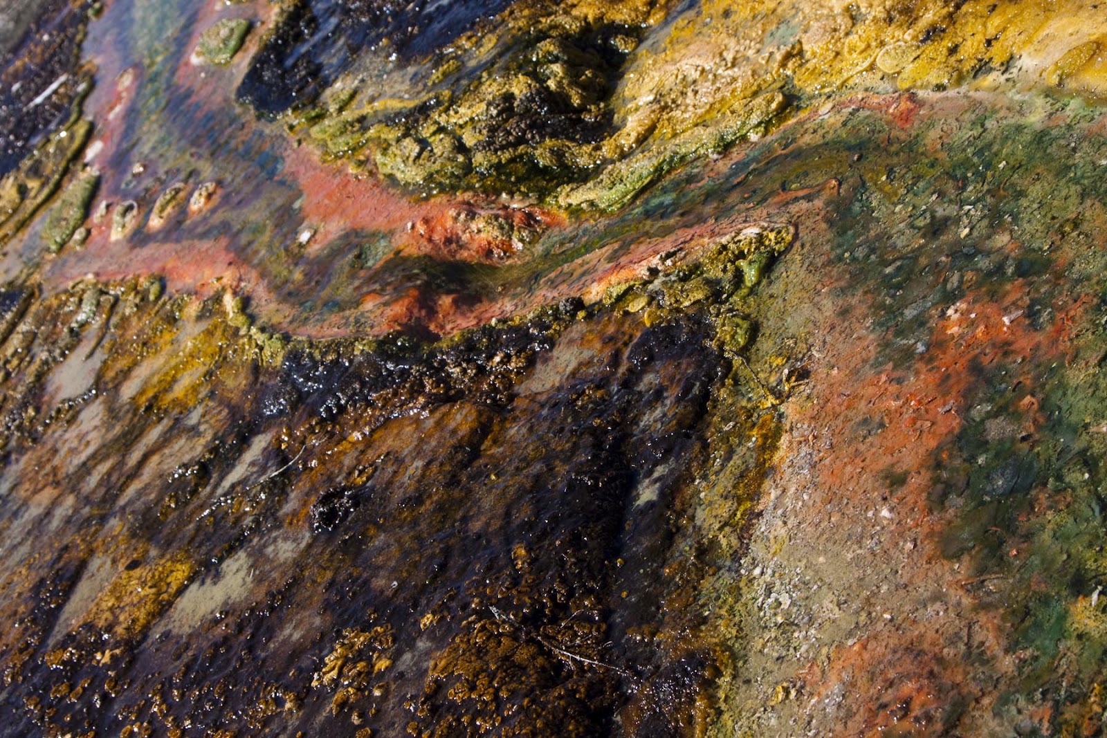
Colourful algae


The Silica Terraces that form the base of Orakei-Korako are believed to be the largest of its kind since the destruction of the famous Pink and White Terraces in 1886 on the edge of Lake Rotomahana beneath Mount Tarawera.

There are 23 active natural geysers that play freely throughout the area, but some, like Diamond Geyser, play very infrequently. Orakei Korako has the greatest number of active geysers of any geothermal field in New Zealand, with the most variable and most interesting changes which lead Lonely Planet to state;


Between Taupo and Rotorua, Orakei Korako gets fewer visitors than other thermal areas because it’s off the beaten track. But, since the destruction of the Pink and White Terraces by the Tarawera eruption in 1886, it has been possibly the best thermal area left in NZ.

Although three-quarters of it now lies beneath the dam waters of Lake Ohakuri, the remaining quarter is the best part.


As we haven't seen any other thermal areas, we'e not sure if we agree yet, but it is it stunning!


Diamond Geezer


We traveled back to Taupo for some lunch and sat by the lake and the Tongariro National Park was just visible and the clouds just about stayed away until sunset!


Monday, 19 March 2012

Tongariro Alpine Crossing

We left Wellington and headed northwards on the motorway up the Kapiti coast.  There were actually cars on the roads, and even a little traffic jam - something we had't been used to in the south! 

We passed through a number of small towns before stopping for lunch in Taihepe - world famous in the gum booot throwing world. Each year the gum boot throwing festival 'attracts participants from all over the world'. We guessed that this means a lot of people in campervans come across this event on the way north! Still they have a nice wellington boot statue in the town! 

We continued north through Wairou, home to the NZ military (signs said no stopping as live firing and explosions were common on both sides!!). An hour or so later and we had arrived in Ohakune - the carrot capital of New Zealand (and they have a carrot statue to prove it!)

There must have been something in the air, as rather than deciding to take a nice gentle chair lift to the summit of Mount Ruapehu (the highest mountain on the North Island) we booked transport to take us to the start of the Tongariro Alpine Crossing - a walk up and over an active volcano!

It looked hard work! So in best preparation we had an nice afternoon beer with Maurice and Anna. Then a late afternoon beer. And a few evening beers too. Oops.


We woke up at 6:30, showered, packed our day bags and boarded the bus at 7:15 heading for the Tongariro National Park. By 8:30 we arrived at the Mangatepopo car park, had a safety briefing and we were off on a 19.4km hike through the volcanoes!

Just 19.4km to go then!
The start was simple - nice and flat with great views over the lava fields towards Mount Ruapeho - still very active, last erupting in 2007 during the ski season.

Mt Ruapeho

Surprising that things can grow here!

Glorious weather 

The flatness and wooden boardwalk soon ran out however and we encountered our first mini climb of the day!


We arrived at the Soda Springs hut after about an hour and had a great view of Mt Ngauruhoe. It also gave us a view of the next section of the walk - The Devils Staircase!

Only 250m in altitude - easy eh?
 Half way up we stopped and admired the views (and let the lactic acid subside a little!) Although you can't see it in this picture you can see all the way to Mt Taranaki - used as Mt Fuji in The Last Samuri as it was much cheaper than filming in Japan.

Half way up The Devils Staircase
We reached the top of The Devils Staircase and the views of Mt Ngauruhoe were sensational. Mt Ngauruhoe (nar-a-hoe-ee) is probably now better known as Mt Doom after Peter Jackson chose it for the Lord of the Rings films.  They are still filming The Hobbit around here now! It is still an active volcano, erupting 44 times in the 20th century, although it hasn't erupted since 1977.
Mt Doom

You can see the lava trails from the 70s

Still no where near half way!
 The next 20 minutes we walked across the south crater of Mt Tongariro. A crater. Of an active volcano. Really?

Nice and flat!
 But soon the flatness gave way to the most difficult climb of the day. It was tough and a little scary in places too!

Who stole the path?

We were now near the top of Red Crater and the views down the Oturere Valley to the Rangipo Desert and Kaimanawa Ranges almost made the 3.5 hours of climbing worth it!


A final 20 minutes and we made it to the top. We were standing above a volcanic crater with fumaroles 6 feet away hissing sulphurous gasses into the air!
Red Crater

The gash from the last eruption

From the top looking down into the crater, we could now see down the other side to Emerald Lakes. These lakes former craters that have filled with rain water and have been coloured bright green due to minerals leaching out of the surrounding rock.


As you can see, the path is a bit steep here and is loose scoria scree underfoot - a bit like walking down sand dunes just a little more difficult and dangerous.  We both ended up an our backsides at least once but made it down safely.


We stopped and had some lunch with the lovely smell of sulphur making our appetites considerably smaller!


So we continued the decent - still not even halfway in terms of kms!

Only 10.4km to go!
 This photo shows the path down from Red Crater to the Emerald Lakes (path starts top right)
At last - more flat bits!
A short walk over the North Crater and we were climbing again, thankfully only about 15mins to the very peaceful Blue Lake.


Sacred to Maori
From blue lake the view back was simply stunning. Mt Tonagariro, Mt Ngauruhoe and Mt Ruapeho all lining up for a photo.
The most amazing view!
 We rounded the corner and Lakes Rotoaira and Taupo were now in view!

Lake Taupo at the back
 And they stayed in view for the next 90 minutes as the path just went on and on and on......

We thought we were near the end, but then the path just continued even further

Looking back

 And to make it worse, we had more climbing to do!


After 6 hours of solid walking, scrambling and climbing we made it down to the car park and on to the bus back to Ohakune.

Awesome walk.

Tired feet.


Friday, 16 March 2012

Bye Bye South - Hello North Island!

Overnight, the 'sunniest place in New Zealand' had the worst storm of the year. The winds reached over 100 kph and many trees came down blocking roads and knocking out power lines. The noise of a storm on a camper van roof is quite loud!

A little tired, we drove to Nelson to attend the 'best farmers market in the area'. When we arrived we guessed it was the only farmers market in the area. 

We drove back towards Blenheim before taking a small country road just passed Havelock - the 'world famous' capital of the Green Lipped Mussel.

Within 10 minutes we were in the Marlborough Sounds (and these are sounds and not fjords!)

Looks like a sound


Imagine what it would look like in the sun! 

The drive along the sounds was twisty and narrow, and we averaged about 30 kph all the way to Picton - the Dover of the South Island. Due to the storm overnight, all of the ferries had been cancelled for the day and our crossing the next day was in doubt.


Picton

We woke up to news that the ferries were indeed running again, and so after brunch and a catch up with Maurice & Anna our new German friends (we have seen them randomly every other day for the last week) we went to check in.

Three hours later and with news that the Cook Straight was 'heavy and less than favourable' (heavy is one less than cancelled and means 5m seas!) we were on board and sailed through Queen Charlotte Sound en route to Wellington and the North Island.

Dark sky but calm seas
The cruise through the sound was fine - a slight rock. Then we were in the open sea. Rough doesn't come close.
The ninety minutes spent on the Cook Straight claimed many victims to sea sickness - even some hard core Harley bikers! But we were fine and were glad to see the calmer waters of Wellington Bay.
Calm again


Another storm brewing?


It was late and dark and we headed for our campsite in the centre of Wellington. It was called Wellington Waterfront Motor-home Park, and it literally was a motor-home park like a car park for motor-homes with a porta-cabin ablution block. But it was in the middle of Wellington so that's the trade off I guess.

We woke up at 5am when a fire engine went passed on the main road 3m away from our heads, and then again at 6am when the commuters started arriving for work, so we gave in and got up.

The first stop was the Parliament. Different to the Houses of Parliament in London as you could walk straight in! The 'Beehive' is the 'world famous' Parliament chamber.

Parliament

Secure

We wandered through town, ran into a chap we met in Dunedin and headed off to the waterfront to visit Te Papa Tongawera, the biggest museum in New Zealand.

The front on the water
Amy's new job as a swimming instructor was over before it really started


Te Papa Tongawera

After running into Maurice & Anna on the escalator, we agreed to meet up for a beer soon, and made a beeline to the Colossal Squid exhibition. It is the only specimen in the world on display and is now carefully preserved to stop it shrinking and deteriorating further. At nearly 500kg, the squid rings would be a mouthful for most people!

Colossal


Big kids!

Te Papa has loads of interactive displays and exhibitions, and one of the most impressive was the aerial map of New Zealand.
Impressive

We wandered around the museum learning about earthquakes, volcanoes, how New Zealand was formed and the perils of lying on a fault line before walking back through Wellington's main square and up to the iconic cable car station.

Beats Aylesbury town centre
We rode the cable car up to the Botanic Gardens and had a great view of the city too.

Great view

Good for the hayfever

We made the most of the sun by having a beer or two on the water front with Damien, a friend from Aylesbury who moved to Wellington 4 years ago, before scoffing a Wagyu beef burger and heading back to our luxurious camp ground. A good first day in the North!

Damo n Dave